

TL;DR
Transport for Great Britain has introduced a real-time digital map of the rail network, offering live updates on train locations and delays. The tool aims to improve passenger information and operational efficiency.
Transport authorities in Great Britain have launched a real-time digital map of the country’s rail network, providing live updates on train locations, delays, and service disruptions. The new tool aims to enhance passenger experience and operational management amid ongoing rail service challenges.
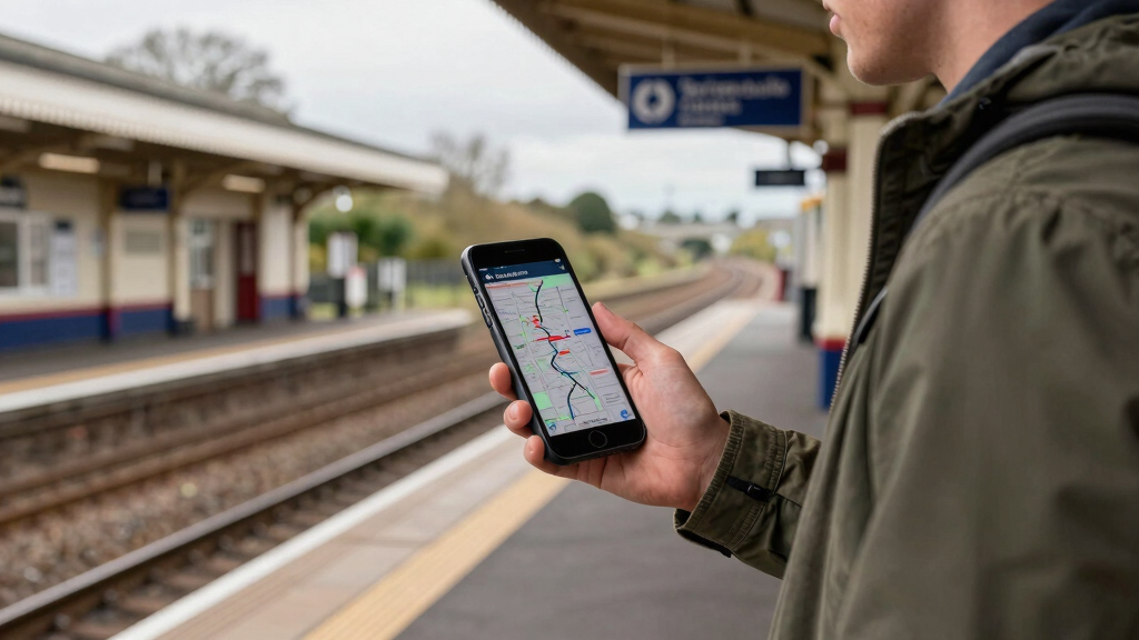
The map is accessible via Transport for Great Britain’s official website and mobile app, displaying current train positions, estimated arrival and departure times, and service alerts across the network. Officials confirmed that the system pulls data directly from train operators’ tracking systems, ensuring real-time accuracy.
According to Transport for Great Britain, the project was developed in collaboration with multiple rail operators and technology providers, with the goal of offering a comprehensive, user-friendly interface for commuters and staff. The map updates every few minutes, reflecting live changes in train movements and disruptions.
While the map is now live, officials emphasized that it is part of a broader initiative to modernize rail infrastructure and passenger information systems, with further features and integrations planned for the future.
Impacts on Commuters and Rail Operations
The launch of a real-time rail map is a significant step toward improving transparency and communication for millions of daily commuters. It allows passengers to make better-informed travel decisions, reduces uncertainty during delays, and potentially eases congestion at stations. For operators, it offers a valuable tool for managing train movements and responding swiftly to disruptions, potentially reducing delays and improving service reliability.
This development also aligns with broader efforts to digitize transportation infrastructure and enhance data-driven decision-making within the UK rail sector, which has faced criticism over delays and service reliability in recent years.
As an affiliate, we earn on qualifying purchases.
Background on Digital Rail Information Initiatives
Over the past decade, UK rail operators and government agencies have invested in digital tools to improve passenger information, including apps and station displays. However, until now, comprehensive real-time maps covering the entire network have been limited or inconsistent. The new map represents a major upgrade, building on previous localized systems and integrating data from multiple sources.
Transport for Great Britain announced in late 2023 plans to develop a nationwide, real-time digital map as part of its modernization strategy, citing passenger demand for more transparent and reliable information. The project has been in development for several months, with pilot phases tested in key regions before full rollout.
“This new real-time map will revolutionize how passengers and operators interact with the rail network, providing instant, accurate information at their fingertips.”
— Transport for Great Britain spokesperson
Unresolved Questions About Data Accuracy and Coverage
It is not yet clear how comprehensive the coverage will be across all regions, especially rural or less-served areas. There are also questions about the system’s accuracy during peak times or in case of major disruptions, and how quickly data updates reflect real-time conditions. Officials have assured that data sources are reliable, but independent verification is ongoing.
Future Enhancements and Broader Integration Plans
Transport authorities plan to expand the map’s features, including predictive delay estimates, integration with ticketing systems, and real-time updates on service changes. Additional features such as crowd levels and accessibility information are also under consideration. The system is expected to undergo continuous updates based on user feedback and technological advancements.
Further testing and user feedback will shape upcoming improvements, with a goal of full nationwide coverage and enhanced functionality within the next 12 months.
Key Questions
How can I access the real-time rail map?
The map is available via the Transport for Great Britain website and mobile app, accessible to all users with internet access.
Does the map cover all train services in Great Britain?
The map covers most major routes and regions, with ongoing efforts to include more rural and less-served areas. Coverage is expected to expand over the coming months.
How accurate is the real-time data on the map?
Officials confirm that data is sourced directly from train operators’ tracking systems, ensuring high accuracy. However, during peak disruptions, some delays in updates may occur.
Will the map include future features like crowd levels or ticketing info?
Yes, future plans include adding features such as crowd level indicators, ticketing integration, and accessibility information, based on user feedback and technological development.
Source: hn